SLAM100 Square Quantity Calculation Solution and Its Case Application
Overview
As the basis and premise of engineering construction, cubic volume calculation plays an important role in the construction of railways, highways, hydropower projects, ports, urban planning and other projects. Accurate calculation of yard quantities plays an important role in resource allocation, project cost estimation, accelerating project progress and It is of great significance to improve the quality of projects. Traditional square measurement methods are mainly based on single-point measurement methods such as total stations and GNSS-RTK. This method is not only time-consuming and labor-intensive, but also has large errors between the calculation results and the actual situation. With the promotion and popularization of 3D laser scanning technology, 3D point cloud data acquisition methods have shown a trend of rapid and diversified development. Its characteristics of rapid and efficient acquisition of high-density and high-precision point cloud data on the surface of accumulations provide a basis for accurate calculation of cubic quantities. new ways.
Current Status of Square Quantity Calculation
At present, the data acquisition methods used for volumetric calculation mainly include traditional surveying, drone photogrammetry, static laser scanning, drone-mounted LiDAR scanning and mobile vehicle/backpack LiDAR scanning. Each collection method has its own advantages and disadvantages. , only applicable to square quantity calculation in a certain scenario.
Simultaneous Localization and Mapping (hereinafter referred to as SLAM) has the ability to start from an unknown location in an unknown environment, locate its own position and posture through repeatedly observed environmental features during movement, and then obtain spatial three-dimensional data based on its own position to construct an incremental approach to the surrounding environment. Map can achieve the purpose of simultaneous positioning and map construction. SLAM does not rely on GNSS and can position and navigate independently. It is suitable for obtaining high-density three-dimensional point cloud data of accumulations in various indoor and outdoor scenes. It can be used with triangulation method, grid method, section method and other square calculation methods to quickly and accurately measure Get the volume of the pile.
Grain storage, grain clearance and warehouse inspection
In the work of grain storage clearance and warehouse inspection, the volume of grain needs to be measured quickly and accurately. The traditional calculation method of grain volume is generally based on the shape of the grain accumulation, by measuring the length, width or diameter, and then using the data volume formula to calculate. Since the length is roughly measured, there are many problems in the grain storage volume obtained by this method. Big error. As the country puts forward the topic of application and development of information technology in the field of grain, how to accurately measure the volume of grain is an urgent problem that needs to be solved.
The collector can obtain the complete continuous point cloud data of the grain pile by holding SLAM100 and walking around the grain pile, which can be used to inventory the grain volume in indoor grain warehouses, establish a three-dimensional visual information file of the grain pile, accurately calculate the volume of each grain pile, and effectively improve the storage clearance inspection. Library efficiency.
Coal mine stripping volume inventory
In mining, the calculation of coal stripping volume is a basic task of mining engineering. Since the stripping volume is crucial to the project cost and plan selection, and the accuracy of its calculation is directly related to the economic benefits of the production enterprise, it is particularly important to use on-site measurement data to quickly, simply and accurately calculate the square volume. At present, there are still many open-pit mines that use GNSS-RTK actual measurement points and use the manual analytical section method and the DTM triangulation method to calculate the amount of earth and stone stripped. Although using this method can avoid the loss of data on slopes, steps, steep slopes, etc., causing the actual measurement to be inconsistent with the actual terrain, the calculation of coal mine stripping volume is a periodic and repetitive work. With the continuous expansion of mining volume and mining sites, the pit bottom It often happens that the GNSS-RTK cannot be fixed, resulting in the efficiency and accuracy of the measured data being unable to be guaranteed, which in turn affects the accuracy of the calculation of the peeling amount, and ultimately affects the efficiency of the production enterprise.
SLAM technology can give full play to its characteristics of autonomous positioning and navigation in the above scenarios, and combined with its advantages of fast and accurate acquisition of point cloud data, it can realize three-dimensional visual display of the coal pile stripping volume and accurately calculate the volume.
Earthwork Calculation for Landscaping Projects
Landscaping projects occupy a very important position in urban garden construction planning, and play a very important role in improving the overall landscape of the garden and standardizing the spatial layout. Complete landscaping renovation construction requires a scientific and reasonable construction plan based on the actual situation of the region, and the accuracy of earthwork calculations has a greater impact on the rationality of the construction plan. Current mainstream earthwork calculation methods include:
① Earthwork construction estimation, directly assess the amount of earthwork required for construction based on the actual construction conditions of the earthwork terrain, and provide important support for the temporary construction of the entire project
② Geometric formula calculation of earthwork figures, considering the amount of earthwork required for project construction as a geometric pattern, and applying scientific geometric calculation formulas to evaluate the amount of earthwork
③Earthwork section calculation method: Calculate earthwork based on section data collected by GNSS-RTK. The earthwork section calculation method is generally suitable for calculation of narrow and long earthwork volumes
④Earth height calculation method: Obtain the section along the direction of the earth contour, and set corresponding contour distances for adjacent sections.
Among them, methods ① and ② are to estimate the amount of earthwork based on experience, and ③ and ④ are to calculate the amount of earthwork based on actual field measurement points. No matter which calculation method is used, there is a large deviation. At the same time, there are many vegetation in the garden, poor visibility conditions, and GNSS The signal is severely blocked, which brings difficulties to field measurements.
SLAM technology is not limited by visibility conditions and GNSS signals in earthwork calculations for landscaping projects. Collection personnel can easily obtain point cloud data in the reconstruction area through the woods. After point cloud correction, denoising, and classification, ground points are obtained. Combined with DTM The triangulation method accurately calculates the amount of earthwork.
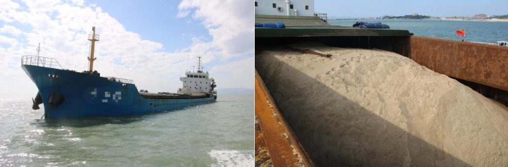
In sea reclamation projects, sand and gravel are the main building materials and the main component of the construction cost. Therefore, whether the sand and gravel materials can be accurately measured directly affects the profit and loss of the project. However, traditional manual measurement is affected by measuring instruments, human factors, and calculation methods, and the error is relatively large. How to accurately measure the dimensions of sand ships is a problem that needs to be solved urgently. The existing calculation method is to use a static scanner to scan the sand pile, and then calculate the sand and gravel volume after splicing and thinning. This method has accurate volume calculation results, but has the following two shortcomings: ① The data acquisition efficiency is relatively low. Low; ② Due to the shaking of the ship in the water, the static scanner is unstable, which affects the point cloud data collection.
SLAM technology is not affected by the shaking of the ship's hull. When the sand transport container ship is empty and fully loaded, you can use SLAM100 to walk around the cabin of the sand transport ship for a week to obtain the point cloud data when it is empty and full. The internal industry calculated the two phases The amount of sand transported this time can be obtained by comparing the point cloud model difference.
Earthwork Calculation for Site Leveling Engineering
The site leveling project refers to transforming the original landform of the project site according to construction needs, using topographic survey results to accurately calculate the amount of earthwork, and then balancing the amount of earthwork filling and excavation, and rationally selecting construction manpower and mechanical equipment. The site leveling project is a reliable basis for controlling the on-site construction plan and progress. It is the key to affecting the cost and investment of the project, and is actually related to all aspects of the project construction. Due to the shortcomings of traditional measurement methods for collecting field data, there are large errors in the calculation of earthwork volume for site leveling projects no matter which calculation method is used. Therefore, it is particularly important to obtain high-precision data to improve the accuracy during the construction process and create higher economic benefits.
The collector holds the SLAM100 and scans around the site to quickly obtain the site point cloud data. At the same time, the non-contact active measurement method of lidar solves the problem of difficult data acquisition in places such as slopes, platform stairs, etc. that are difficult for people to reach, and truly achieves a three-dimensional real scene of the site. After re-engraving, the interior industry can obtain the ground points of the site through coordinate conversion and classification. According to the terrain characteristics of the site, the earthwork calculation method can be reasonably selected to calculate the fill and excavation balance.
Solution
Supporting software
SLAM GO is a mobile APP used in conjunction with SLAM100. The APP can be connected to the SLAM100 device through a mobile phone for project management, real-time point cloud puzzle display, image preview, firmware upgrade and other operations.
SLAM GO POST Pro is a PC-side software that matches SLAM100 and is embedded in Drone Manager Professional Edition. This software can perform post-processing of data collected by SLAM100, produce high-precision, high-definition color point clouds and partial panoramas, and can perform point cloud browsing and optimization.
Intelligent Point Cloud has basic functions such as browsing, rendering, denoising, resampling, redundancy removal, and coloring of point cloud data. It also has fast automatic filtering and classification functions as well as convenient and diverse data interactive editing tools.
CloudCompare is a free commercial software that uses the grid method to calculate earthwork based on point cloud data. The grid size can be set by yourself, and the change amount of earthwork in two periods of point cloud and the amount of earthwork in one period of point cloud to the specified elevation can be calculated.
CloudCompare Earthwork Calculation
1) On-site inspection
View the survey area overview on the spot, understand the survey area routes and feature distribution, and the connectivity of various roads, exits, and passages to facilitate subsequent scanning route planning.
2) Control point layout
Some projects require point cloud data to be in an absolute coordinate system. GNSS-RTK or a total station can be used to measure control point coordinates for subsequent automatic extraction and coordinate conversion of control points. If there are no requirements for point cloud data, this step is not necessary.
3) Route planning
Plan scanning routes
Based on the mastered survey situation and control point distribution, rationally plan the scanning route. The most ideal scanning line is "closed-loop scanning". To perform "closed-loop scanning", you only need to simply return to a previously scanned point, and the software will automatically identify the overlapping area. This step is used to calculate and correct any offset or tracking errors that have occurred, similar to "closing the loop" in leveling. When a closed loop cannot be formed due to conditional constraints, the post-processing and calculation software SLAM GO POST Pro provided by SLAM100 can still ensure the quality of point cloud data.
Data Collection
The collector holds the SLAM100 and collects point cloud data according to the planned route. When walking near the control point, the cross center of the SLAM100 base coincides with the control point and leaves it alone for 10 seconds. During the scanning process, the real-time point cloud splicing effect is browsed through SLAM GO. If any If missing, make up for it in time to ensure the integrity of the point cloud data.
SLAM GO real-time display
Use SLAM GO POST Pro for one-click post-processing of raw data to produce high-precision point cloud data, color point clouds, partial panoramas and other results.
Local point cloud effect
partial panorama effect
2) Coordinate conversion
SLAM GO POST Pro adopts an automated method of extracting control points and relies on algorithms to extract control point positions from point clouds for coordinate conversion to avoid errors caused by manually adding control points.
3) Accuracy check
Import the point cloud into the smart point cloud, and use the [Accuracy Check] tool to check the accuracy of the converted point cloud. If the error between the point cloud and the check point meets the accuracy requirements, subsequent square volume calculations can be performed.
Point cloud classification
The purpose of point cloud classification is to accurately extract ground points. This step is an extremely critical step, which determines the accuracy of the square quantity calculation. The collector holds the SLAM100 to acquire data at close range, and the point cloud penetration effect is good. Combined with the automatic classification algorithm of intelligent point cloud ground points, ground points can be quickly and accurately separated.
ground point
Square quantity calculation
CloudCompare software is used to calculate square quantities, and parameter settings such as grid size, reference surface, and grid height are determined based on the classified ground points and the square quantity results are output.
Earthwork calculation results
This solution successfully applies SLAM100 in square quantity calculation. SLAM100 is used to fully obtain the point cloud data of the survey area. Ground points are obtained after coordinate conversion and point cloud classification. Combined with third-party software, the square quantity is accurately calculated based on the ground point cloud, which can be used for subsequent Provide data support for renovation construction. The program has the following features:
1) Innovates the way to obtain measurement data, and relies on autonomous navigation and positioning to build high-precision incremental maps in a GNSS-free environment;
2) It breaks through the constraints and shortcomings of traditional measurement methods to obtain a single point, solves the trouble of frequent station changes and point cloud splicing of static scanners, and improves the efficiency of internal and external operations;
3) The handheld collection method ensures the penetration of data, and the supporting software SLAM GO ensures no blind spots in the field to scan and ensures the integrity of the point cloud;
4) The relative accuracy of the industrial-grade SLAM post-processing algorithm in solving point clouds is better than ±2cm, and the absolute accuracy is better than ±5cm, ensuring the accuracy of earthwork calculation results;
5) Intelligent Point Cloud automatically extracts ground points with high accuracy, reducing the heavy manual classification workload and improving internal efficiency;
6) CloudCompare uses the grid method to calculate the amount of earthwork in one phase and multiple phases based on ground point cloud. The software has a wide range of applications, strong data carrying capacity, simple operation, high precision, and fast computing speed;
7) Integrated software and hardware solutions, seamless connection of data results, suitable for volume calculation in various scenarios.
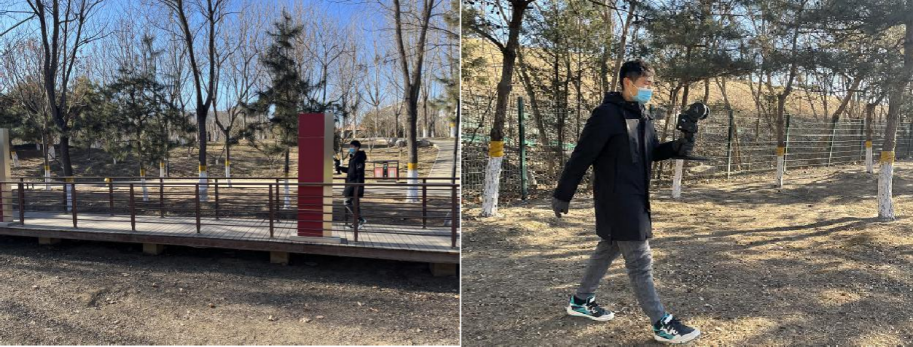
Park renovation and expansion
In order to increase the green plant coverage area in a certain park, it is necessary to plan and reconstruct the existing site, and accurately calculate the earthwork volume of the reconstructed site to provide data support for the construction. The reconstruction area is located in the central area of the park, covering an area of approximately 1,500 m². The terrain is not undulating, and the vegetation coverage is high. The GNSS signal is severely blocked, and the visibility is blocked.
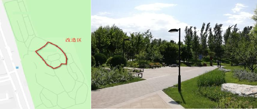
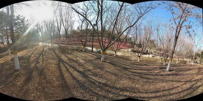
Location and overview of the reconstruction area
Collectors collect data on site, which not only solves the problem of conventional measurement methods being unable to perform measurements due to force majeure (vegetation obstruction, etc.), but also avoids the trouble caused by frequent station changes of static scanners, point cloud splicing, etc., effectively improving operational efficiency. During the scanning process, use SLAM GO to browse the real-time point cloud splicing effect. If there are any missing points, scan them in time to ensure that the point cloud data is complete. Field scanning takes 10 minutes.
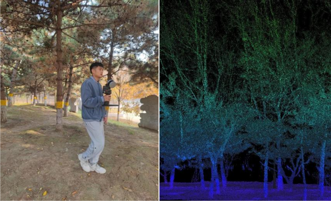
Field data collection (left), original point cloud data (right)
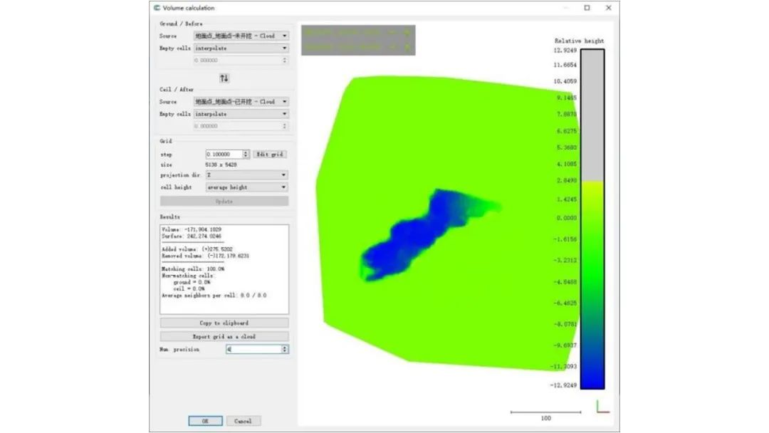
The original data is imported into SLAM GO POST Pro for post-processing to generate a high-precision point cloud map. After point cloud classification, CloudCompare is used to calculate the volume. The internal processing took 1.5 hours. According to the actual situation on site, the filling volume of 85m³ was ignored, and the excavation volume was 2898.107m³.
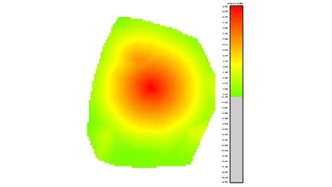
Ground point and triangle mesh rendering
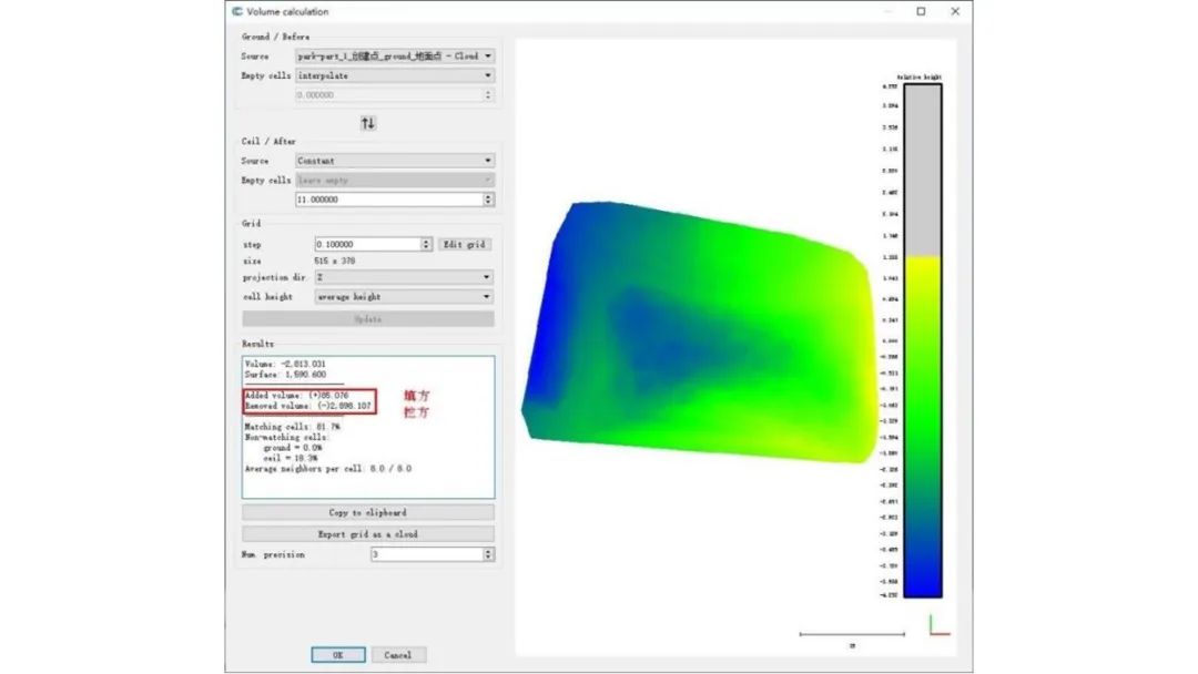
Earthwork calculation results
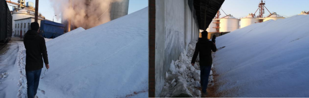
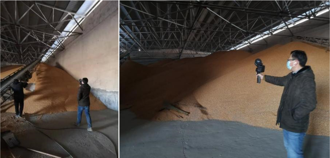
A certain granary needs to regularly check the remaining grain in the warehouse. The GPS signal cannot be received in the warehouse and airborne Lidar radar cannot be used to obtain data. The height of the grain pile is about 4-5m, and the static scanner cannot obtain data on the top of the grain pile. Walk around the grain pile with a hand-held SLAM100 and use the extension rod to obtain a complete three-dimensional point cloud result. Due to the different sizes of the grain warehouse, the scanning of a single grain warehouse takes about 5-7 minutes.
After denoising and cropping, the grain pile point clouds are separated separately. There are no cluttered point clouds on the grain pile surface and storage can be calculated directly. The grain storage volume of one of the grain silos is 3400m³. It takes about 25-30 minutes to inventory the reserves of a grain depot, depending on its size and internal space layout.
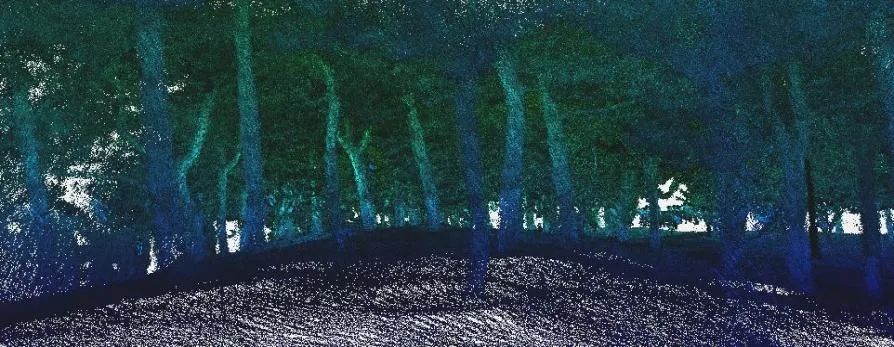
SLAM100 grain pile scanning site
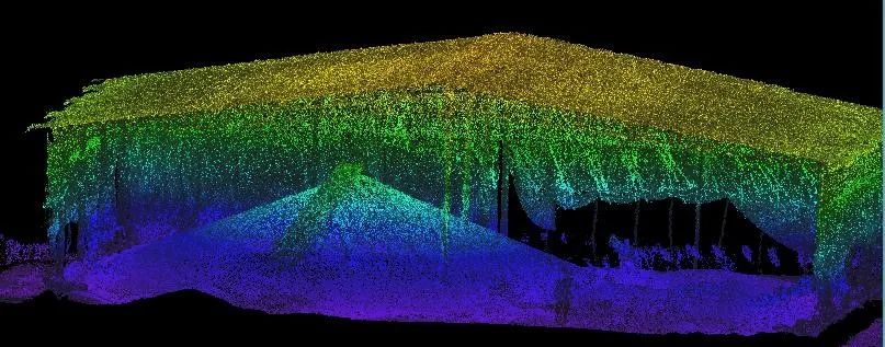
Liangdui point cloud
Grain pile calculation
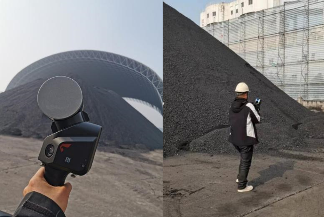
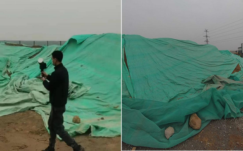
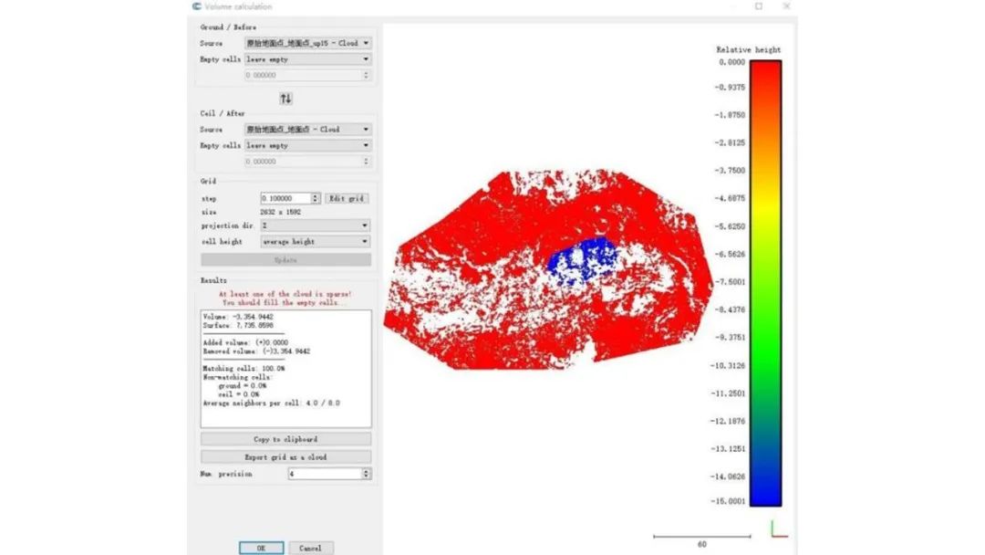
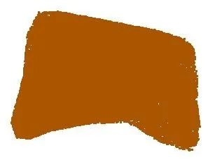
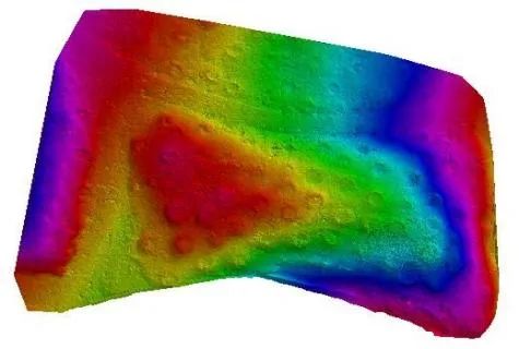
A large amount of construction waste was generated during the construction process at a construction site, and it is now necessary to determine its volume to formulate a cleanup plan. The construction waste covers an area of about 1,400 square meters and is extremely irregular in shape. If a static scanner is used, it needs to be set up 12-14 times to complete the scan. Pegasus technicians held the SLAM100 and scanned along the periphery and top of the construction waste once to obtain continuous pile data, eliminating the need for post-production splicing. It took 9 minutes for field workers and 1.2 hours for in-house staff to denoise and crop the point cloud data. , classification and other operations, the volume of the pile formed by the construction waste and the ground is calculated to be 2704.506m³.
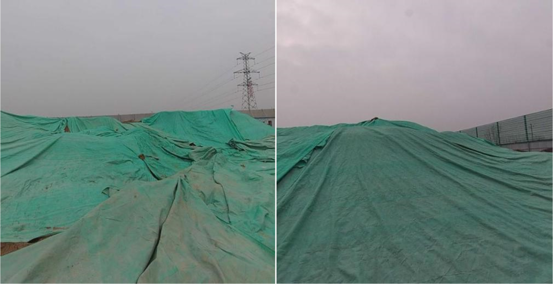
construction rubbish
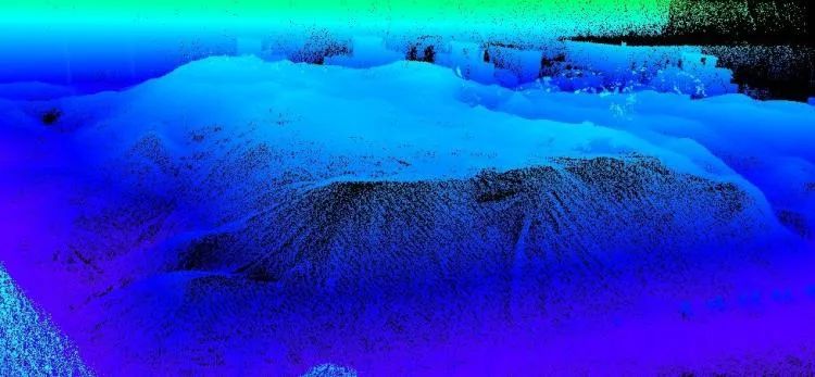
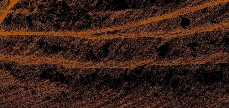
Construction waste point cloud image
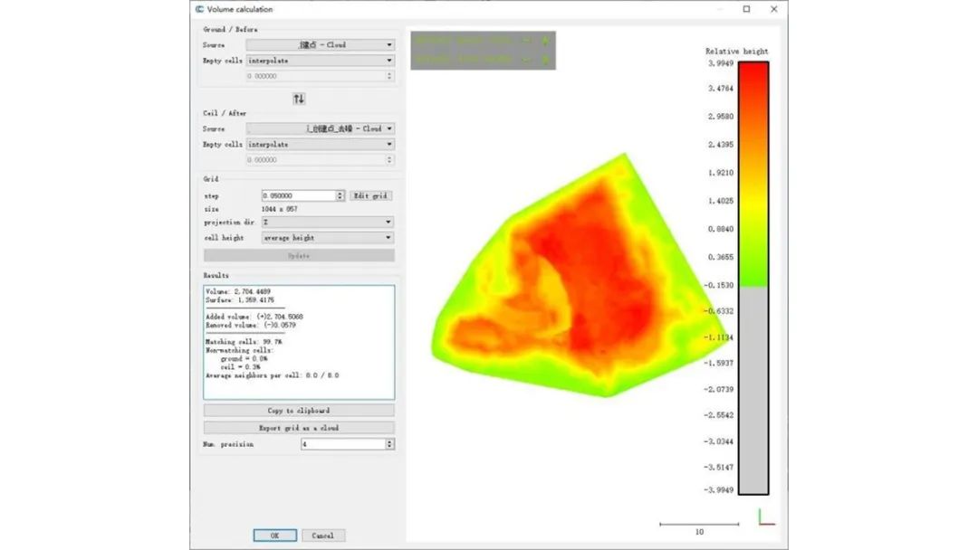
Volume calculation results
