Notes on Aerial Survey Operations of V10 Equipped with DV-LiDAR10 in Zuogong Canyon Area, Tibet
The southwest mountainous area has high mountains deep valleys, and rapid rivers. The abundant water volume and huge drop have formed extremely rich water resources. National hydropower construction is blooming all over the southwest. The representatives Baihetan and Wudongde are on the Three Gorges level in terms of installed capacity and water storage scale.
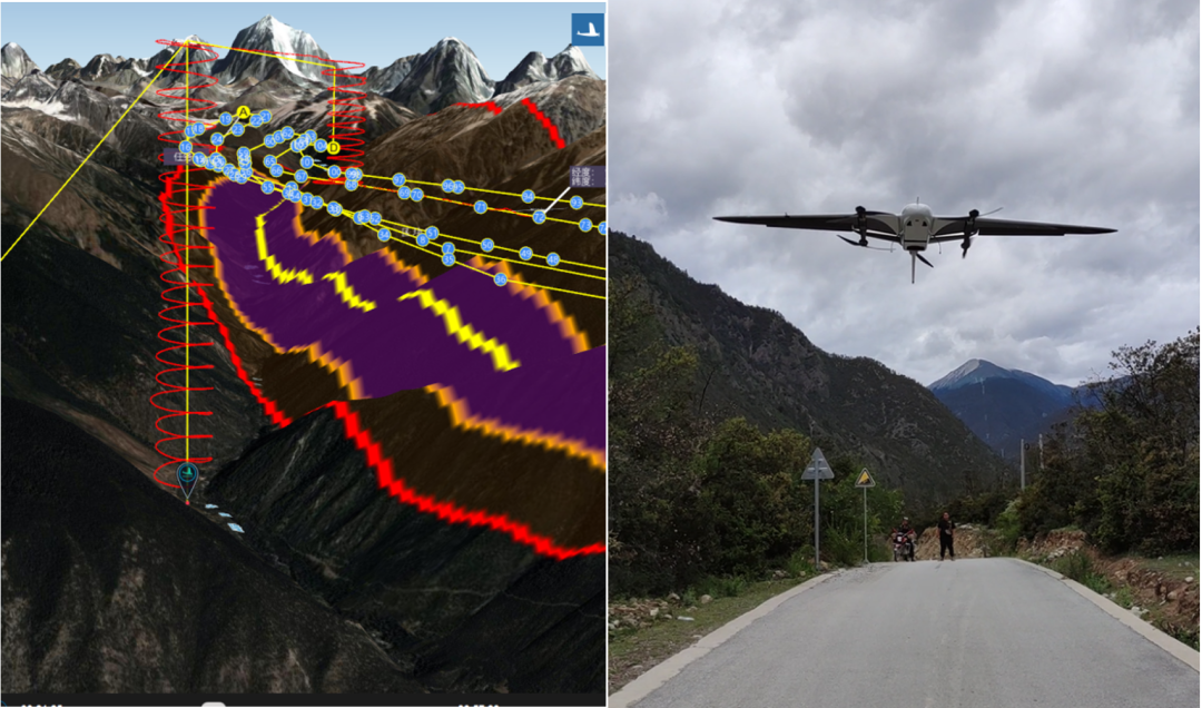
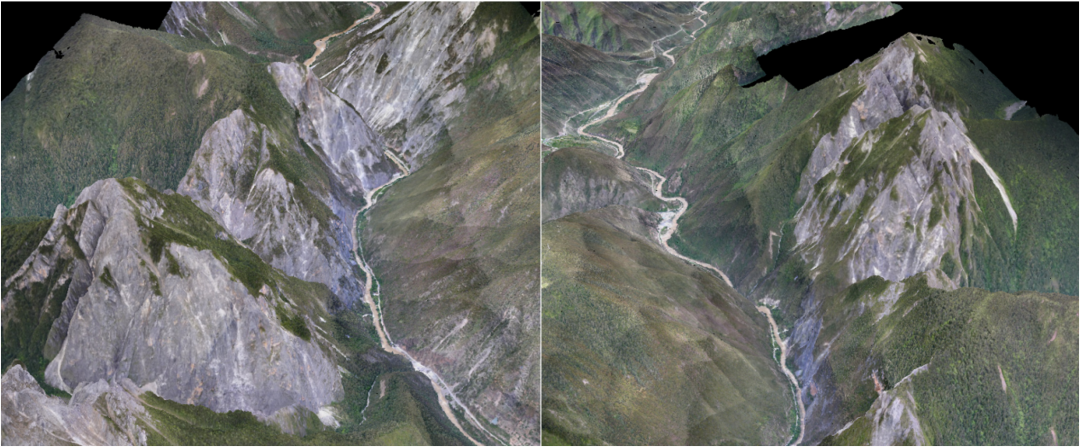
The survey area for this trip is located on both sides of a certain river in Tibet. Hundreds of millions of years of water cutting have carved a deep ravine on the towering Qinghai-Tibet Plateau. From the highest snow-capped mountains nearby to the bottom of the valley where the river flows, there is a vertical drop of two More than a thousand meters, the horizontal distance is only six or seven kilometers. The difficulty of flying in such steep terrain is evident. The task of the survey area is to complete the terrain and feature survey in the early stage of construction of a hydropower station in Tibet. The survey area is a valley area with a length of 32km and a width ranging from 1km to 5km. The altitude is between 3300m and 4000m. The rapid changes in weather have increased the difficulty of aerial survey operations.
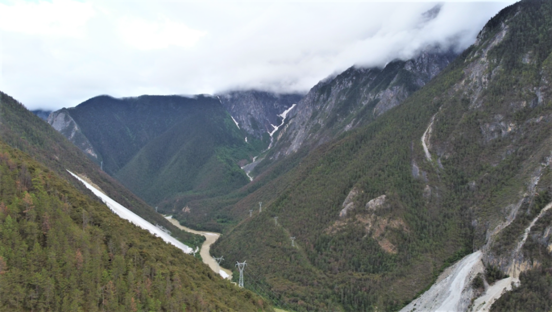
Topography of survey area
Flight
With all the preparations for route, venue, and airspace coordination in place, the weather became the only factor restricting the flight—it was cloudy and foggy in the morning, and the strong winds of ten meters in the afternoon were prohibitive; later, the warm and humid air currents from the Indian Ocean came, The rain has come to join in the fun again. One moment it was a clear sky, and the next moment we saw rain clouds suddenly coming over the mountains. At first, we judged the precipitation based on satellite cloud images, but later we found that these rain clouds did not show anything on the cloud images. There was nothing on the cloud images. When the clouds drifted over, it would rain for a few minutes, and it was not much or too much. Just a few minutes. Always be prepared and always buffered, taking off is not easy.
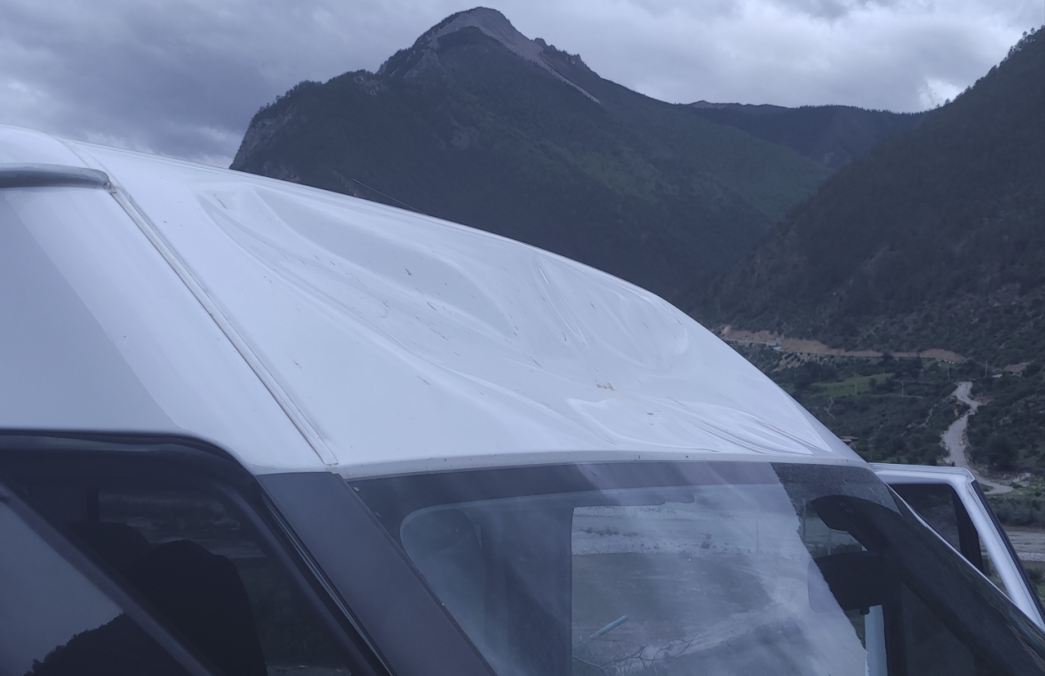
There are strong winds in the measurement area every day, with different wind speeds on the ground and in the upper air. Many times the wind is very strong on the ground, but very stable at high altitude. Sometimes the wind on the ground is very light, and a strong wind warning is issued as soon as the plane takes off. The normal airspeed when flying on a plateau is 20m/s. Once I flew into a canyon terrain at high altitude and encountered strong instantaneous winds, my cruising speed was close to an astonishing 40m/s.
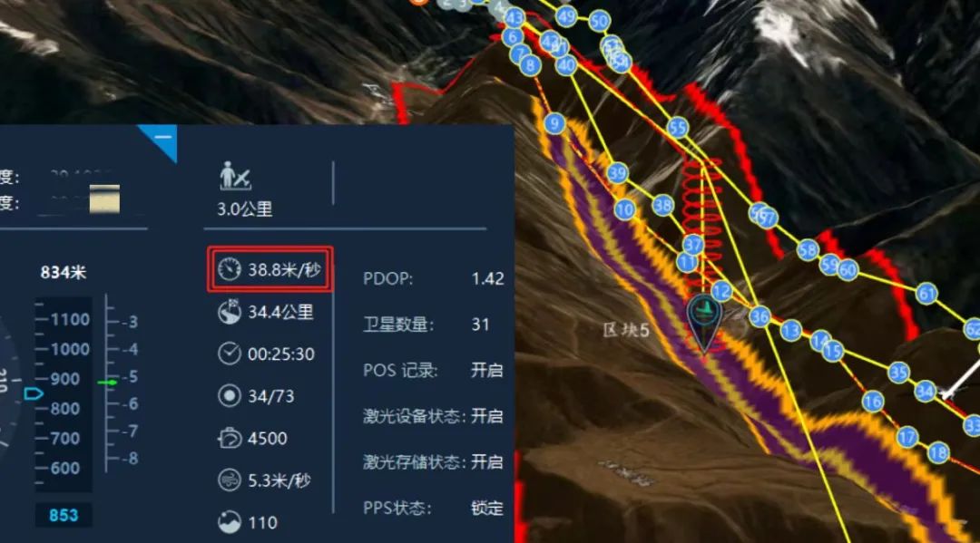
V10 flying in strong winds
The actual battery life of the V10 equipped with LiDAR10 is about 2 hours, and it can withstand level 7 winds. When the wind speed is greater than 10m/s, the ground station will prompt the pilot to pay attention to flight safety; when the instantaneous wind speed reaches 15m/s, the aircraft will trigger the self-protection mechanism Automatic return.
When the aircraft is performing a mission, field personnel can perform on-site calculations on the previous flight data while monitoring the situation of the drone in real time. The Intelligent Map and Intelligent Laser modules of Foxtech Robot UAV Manager can easily and quickly perform pre-processing operations such as point cloud data analysis, so that on-site field personnel can check the data quality of the flight area at the first time.
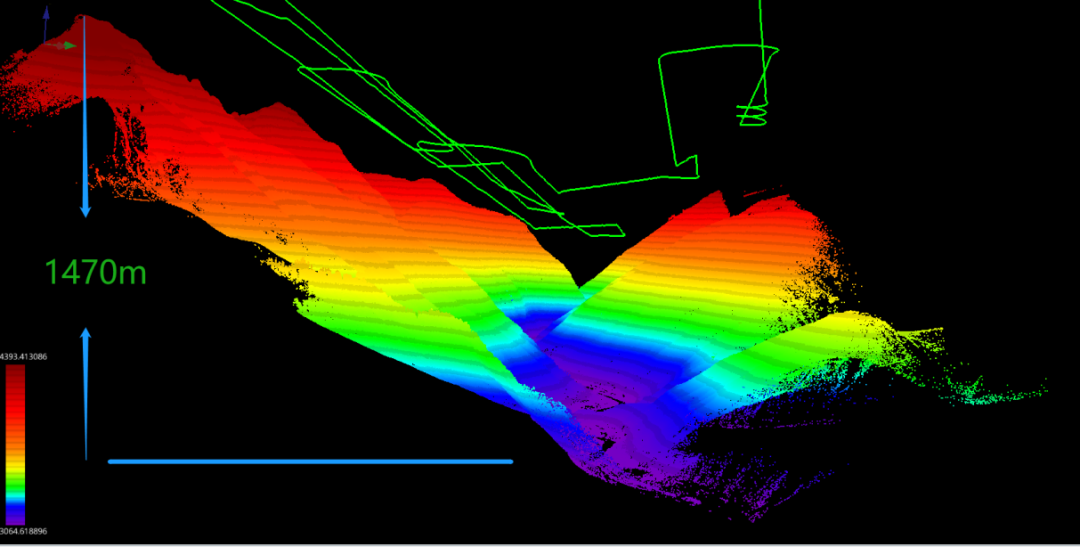
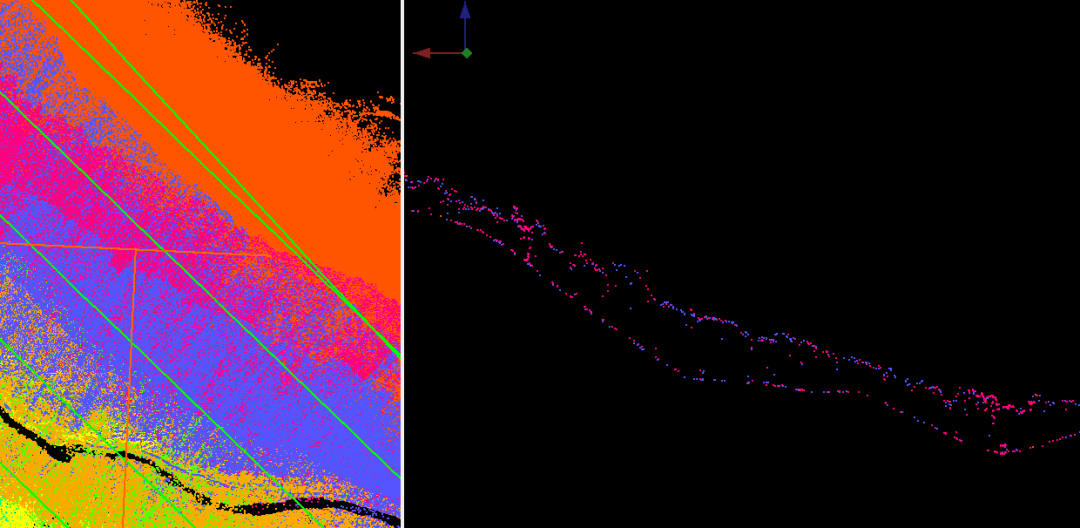
Single flight trajectory and preliminary solved point cloud
The point cloud of a single sortie reflects that the height difference in the measurement area reaches 1470m. The maximum measuring range of DV-LiDAR10 is 1500m (ρ>80%). Under the normal reflectivity of ground objects, the relative altitude of 1000m is the limit of actual combat data. For this kind of high-drop terrain, long-endurance drones can fly at higher altitudes. Best solution.
After completing the flight according to the preset route, the V10 automatically returns to the HOME point and then begins to circle and descend. The landing circle radius is the same as the take-off circle radius of 80m. When the aircraft hovers to the set switching rotor height, the aircraft automatically switches to the rotor. Then the aircraft locates the HOME point and begins to descend. When it lands at a certain height above the ground, the downward-looking ultrasonic radar determines the aircraft's height above the ground in real time, and the vision module assists in positioning and correcting the aircraft. In the flat position, the entire flight process basically requires no manual intervention to land.
Landing aircraft and ground station display
The data obtained in the field include airborne logs, photos, LiDAR raw data and IMU data. The Guanjiazhi laser module is used to perform point cloud calculation and quickly output point cloud data.
Inter-airline quality inspection/air-belt adjustment
Check whether there is stratification between flight strips. If so, use flight strip adjustment to improve data accuracy.
Sectional view
Point cloud data processing
Smart Laser can perform preprocessing operations such as point cloud denoising, redundancy, and coordinate conversion, and output standard point cloud results that meet the result requirements.
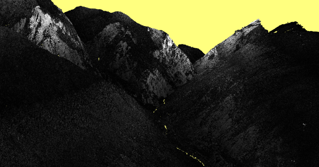
Standard Point Cloud - Intensity Rendering
Point cloud data post-processing
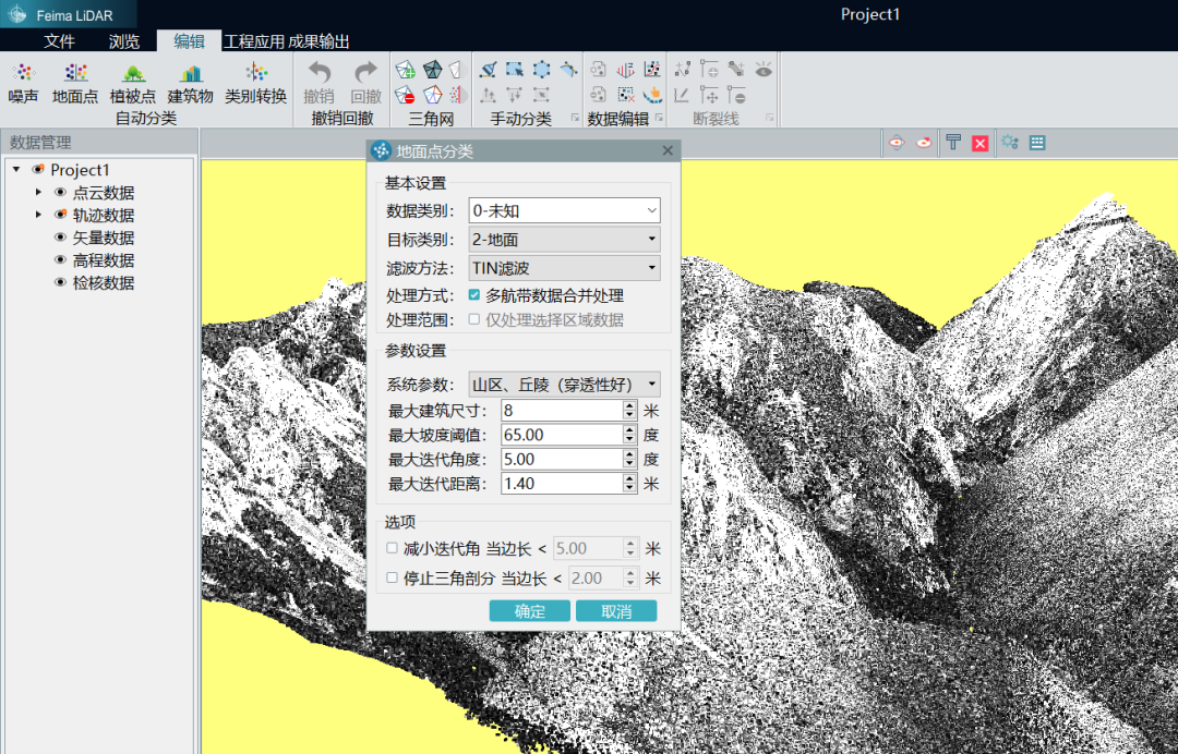
Intelligent point cloud point cloud automatic filtering
You can use the Guanjia Intelligent Point Cloud module for filtering processing. For the same type of topography, first use appropriate parameters to perform local filtering of the measurement area, then perform global filtering after confirming the parameters, and then construct a TIN as a whole to view the classification of the measurement area. For manual filtering of areas with poor local classification, online and offline classification, smoothing, break line and other classification methods can be used for manual classification. In addition to classifying ground points, the smart point cloud module can also classify common point clouds such as ground points, buildings, transmission lines, and vegetation.
Orthophoto Processing
While DV-LiDAR10 acquires point cloud data, it can also acquire orthophotos. By directly using the image data to colorize the point cloud, it can output a colored point cloud.
Point clouds given visible light texture
In addition, the UAV Butler Intelligent Puzzle module can be used alone to output DSM and orthophoto products. The picture shows the whole and part of the DOM image of the survey area. The cliffs, glaciers and trees in the survey area can be seen in the right picture. To carry out aerial survey operations in an area with such a large altitude difference, long-duration and high-altitude flights are an effective means to ensure the quality of the results.
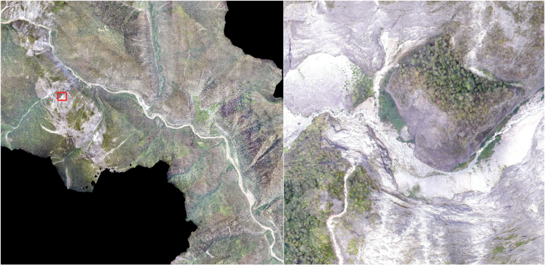
orthophoto
DEM and Contours
Use the UAV Butler Intelligent Point Cloud module to output DEM, select the required data, set the resolution and construction method, etc. to generate DEM data.
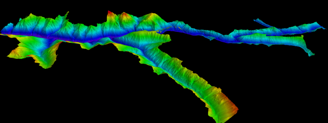
Survey area DEM
Contour lines are generated based on DEM or ground point cloud. Select the result output through the UAV Butler Intelligent Point Cloud module, then select the contour line, set the corresponding contour distance, reference height, smoothing coefficient and sampling interval, and then the corresponding contour data can be output.
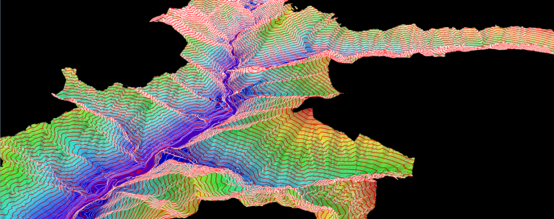
Survey area DEM and contours
Pay attention to the weather
The altitude in the plateau area is higher, and people coming from lower altitudes will feel more or less uncomfortable. They will feel dizzy and weak at first, and they will gasp when they move. It will get better gradually. However, you still need to pay attention to your body and avoid catching cold, otherwise the high altitude will make you worse. It's very uncomfortable to catch a cold. If your body feels unbearable, don’t force it and return to a lower altitude immediately. Pulmonary edema and cerebral edema caused by altitude sickness should not be underestimated. Here are some tips for working in plateau mountainous areas: (1) Avoid strenuous exercise on the plateau, unless there are yaks chasing you; (2) The temperature difference between morning and evening is huge, so be sure to bring thick clothes when going out every day. If it is a jacket, both inside and outside You must wear layers, the inner one is for keeping warm, and the outer one is for windproof and waterproof; (3) Pay attention to sun protection, the solar radiation on the plateau is strong, and you will definitely lose a layer of skin if you are exposed to the sun for a day; (4) The weather on the plateau is changeable, so a hat is a must. Not only to protect yourself from the sun, but also to protect yourself from the wind. Being blown by the wind for a while will make you dizzy. This is why Tibetan compatriots often wear hats.
Caution Falling Rocks
There are often rocks falling due to weathering under steep cliffs, and even more rocks fall after rain. On this kind of road, try to take a car instead of walking. During the operation, we suddenly encountered a loud noise while driving, and the car body shook violently. The three of us were frightened. When I got out of the car to check, I found that a big rock fell from the mountain and hit the car. If the speed had been a little slower and the rock had hit the front windshield, the consequences would have been disastrous.
A car hit by a rockfall from a mountain
Don't go up the mountain to dig up Cordyceps.
Cordyceps has become magical after being commercially processed. In fact, it is the grass that grows out of the bodies of insects after they die. Its price has seriously exceeded its medicinal value. The plateau in the survey area is steep, and mainlanders simply do not have the physical strength to climb on the plateau. It is hard to say whether they can make it down the mountain if they encounter bumps and bumps. In addition, wild insects may carry pathogens to which mainlanders do not have antibodies. , it doesn’t matter if you get bitten by bugs a few times, what matters is that you are likely to get an infectious disease. Tibetan fellows riding motorcycles up the mountain to dig up Cordyceps. When they see our small plane, they will come over and take a few photos. During the chat, they learned that the price of Cordyceps ranges from 20 to 50 yuan per piece depending on the size of the individual. The picture below shows the freshly dug Cordyceps. So soft and scary.
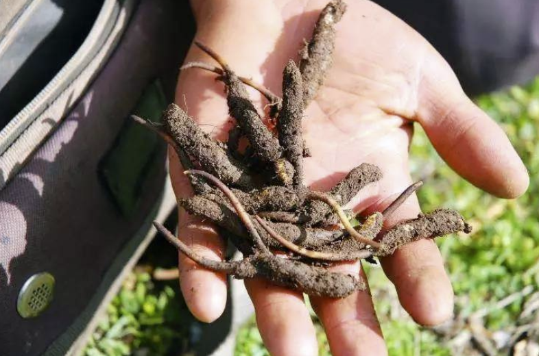
Cordyceps
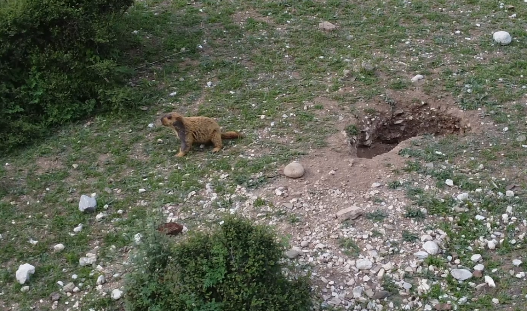
Don't mess with wild animals
Don't provoke wild animals, not even horses, cattle, or sheep. You'll really make them anxious. In that environment, you can't beat the sheep. You can see if the prairie dog is OK, but don't catch or touch it, because the prairie dog has It harbors a variety of parasites and carries a variety of germs, including Yersinia pestis.