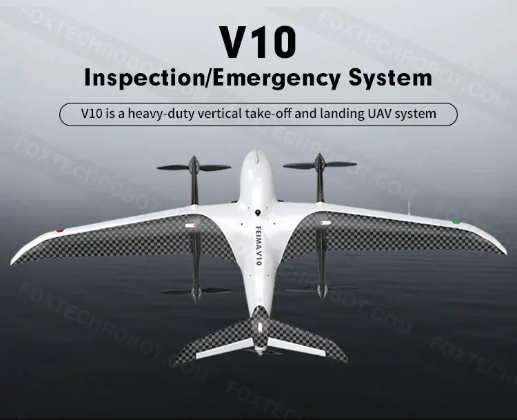
Foxtechrobot | V10 RTK Drone UAV for Land Surveying and Topographic Mapping
Product Introduction:
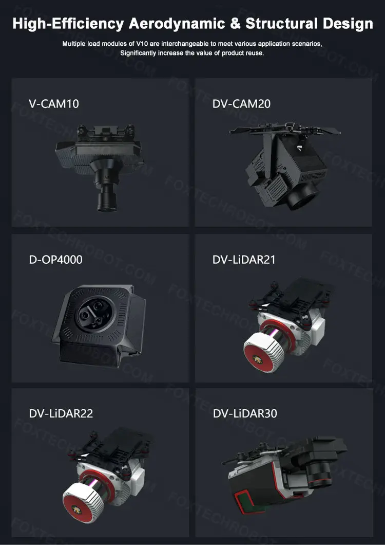
V10 is a heavy-duty vertical take-off and landing UAV system, Using universal intelligent power batteries and high-end load equipment, it can be equipped with a visible light aerial survey module, visible light tilt module, visible light video module, thermal infrared camera module, thermal infrared video module, multispectral module, hyperspectral module, lidar module, synthetic aperture radar module, and some combination modules. Equipped with a high-precision differential GNSS board, standard network RTK/PPK, and its fusion solution service, supports high-precision POS-assisted aerial triangulation. It has the ability of 1:500 large-scale mapping without control points and realizes the application of image control free.
Product Features:
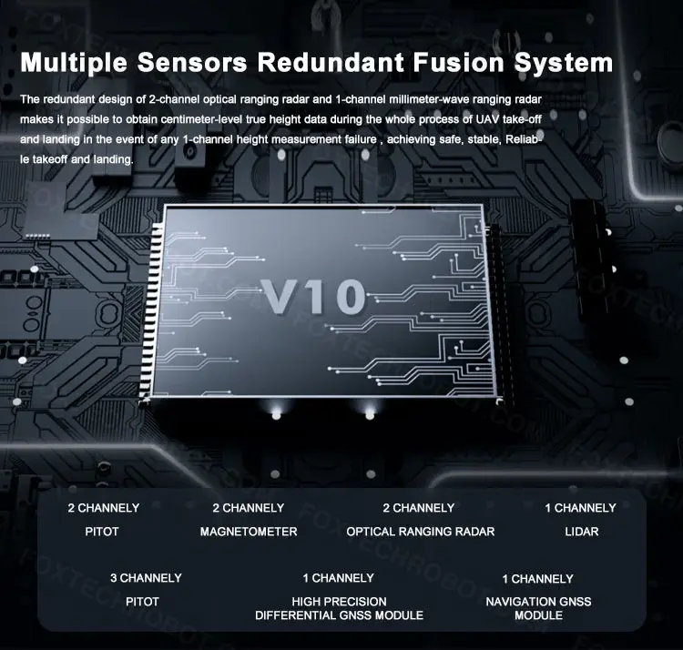
-Multiple Sensors Redundant Fusion System
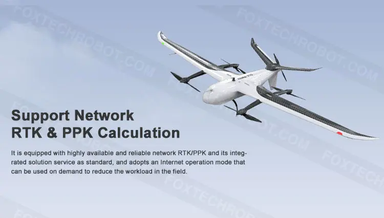
-Support Network RTK & PPK Calculation
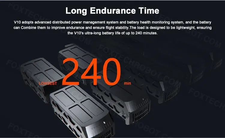
-Long Endurance Time &Distributed Power Management
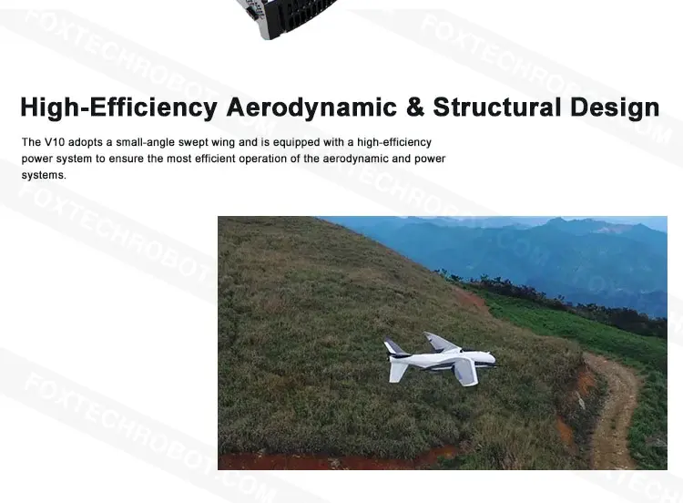
- High-Efficiency Aerodynamic & Structural Design
-Multi-load Module Interchangeable design
We can provide free software service!
For more software information, please refer to:https://www.foxtechrobot.com/blog/

.jpg-f)
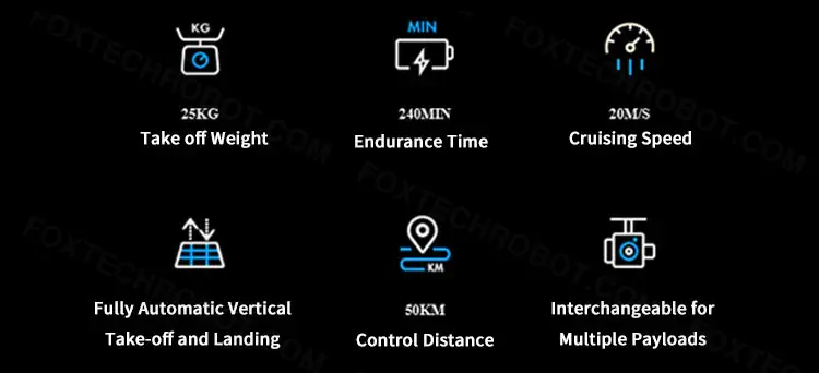
| Specification |  |
|---|