Exploring New Fields - Foxtech Robot Focuses on Building a Cheese Service Platform
The Cheese Division is a division established by Foxtech Robot for the general surveying and mapping industry focusing on aerial surveying, remote sensing and customized R&D services. It provides industry users with services such as UAV flight, data processing, airspace consulting and system customization. Its subsidiary Cheese Network is a professional space remote-sensing public service platform. Based on the capabilities and advantages of Foxtech Robot, Cheese Network aims to build an open, shared, and guaranteed resource-based service platform. Focus on the space remote sensing business and pan-industry customers on both supply and demand sides, create a high-quality industrial integration ecosystem, promote the business extension of partner industry customers and the upgrade of Internet service models, and jointly continue to create and maximize the value of products and data.
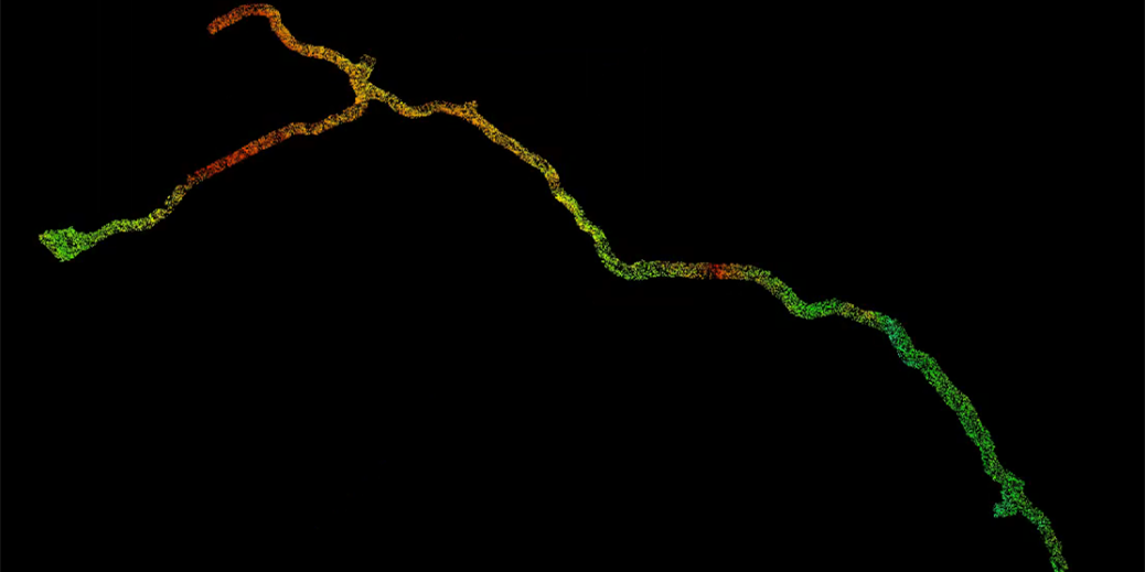
Typical Case One: Tibet High Altitude Aerial Survey Project
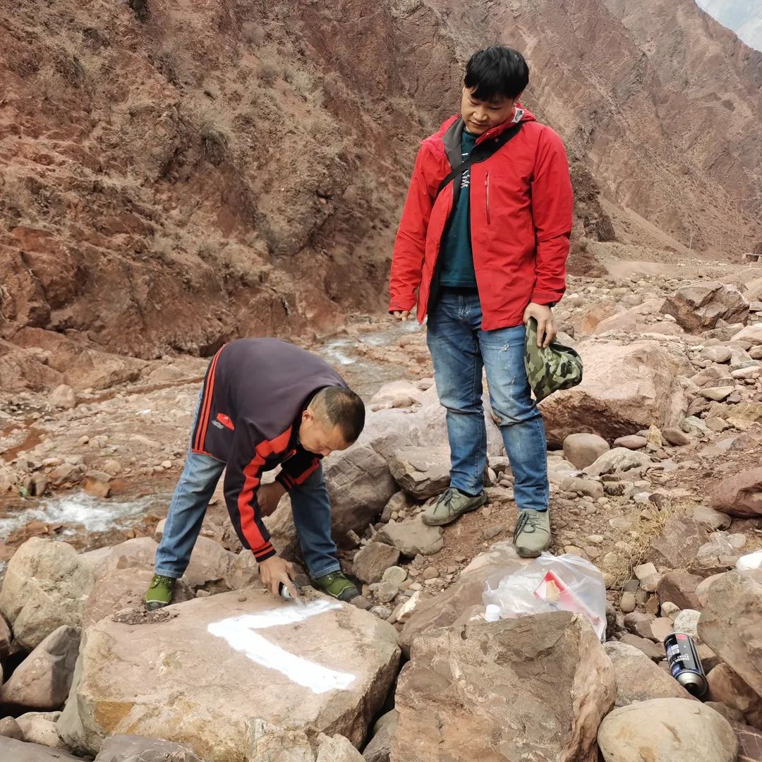
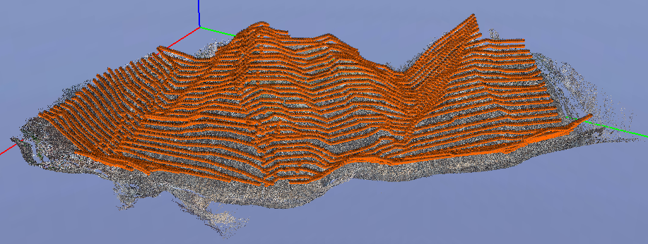
Project Overview: The test area is located in a certain area of the Tibet Autonomous Region, with a maximum altitude of 4,500 meters and a minimum altitude of 2,600 meters. It requires manual equipment to climb to a mountainous area with an altitude of 3,100 meters for flight, which is a great test for both personnel and equipment performance. The local weather environment changes rapidly, with the maximum wind reaching level 8, which cannot meet the needs of operations most of the time. The geographical environment is dangerous and it is difficult to select a take-off and landing site. The operation needs to be carried out in an area of less than 5 square meters.
Main work contents:
1) Obtain oblique aerial images better than 0.06m in the area;
2) Produce a 3D model with a resolution of 0.06m (OSGB format).
Control point situation: Due to the steep terrain, zoning is difficult and phase control points cannot be distributed evenly. Phase control points can only be laid out along the road, which requires extremely high precision control.
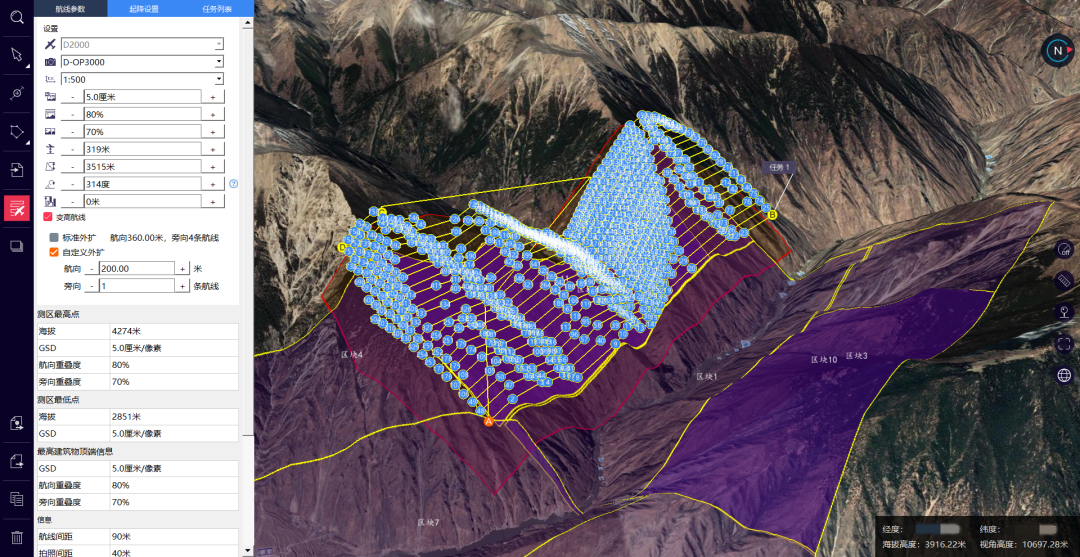
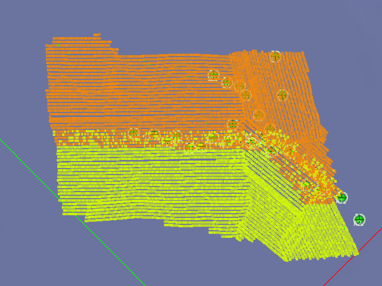
Project implementation: Due to the large altitude difference in the measurement area, a D2000 drone equipped with a D-OP3000 oblique photography module was used for this flight, and RTK+PPK mode was enabled throughout the flight. At the same time, the altitude-changing mode route is planned according to the terrain undulations, and the altitude-changing flight is carried out to fit the terrain. The relative height of the aircraft and the measurement area are kept consistent, thereby ensuring the consistency of image resolution.
According to the characteristics of the wide coverage area of the survey area, the original data was acquired using a block processing method with a flight altitude of 319m, a route overlap of 80%, a side overlap of 70%, and an average resolution of 5cm. The total flight time is 3,000 minutes, with an average of 13 flights per day, and the flight operations are completed in 7 days.
In order to avoid edge errors and loopholes between partitions, data processing is carried out according to the distribution of control points, and the model is produced in units of whole blocks, while ensuring that the number of common control points in the overlapping areas between blocks is maximized.
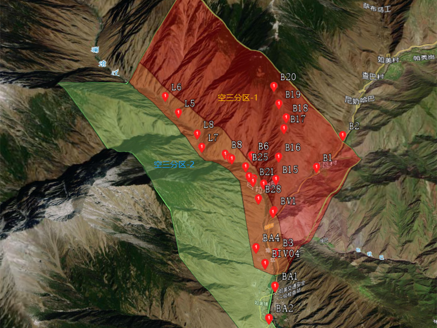
In high mountainous areas, flying in areas with weak textures can be accomplished in three passes in one go. The total project area is 37.8 square kilometers, it requires 2 staff members and takes 6 days.
![]()
Typical Case Two: Guangxi Emergency Surveying and Mapping Linkage Service Platform Construction Project
Project Overview: This platform is a drone emergency surveying and mapping linkage service platform built by Cheese, with a dispatch center, a public portal and a distributed team terminal as the main structure. It can be connected to the current mainstream surveying and mapping drone equipment, emergency response vehicles and emergency response teams. By linking the relevant functions of UAV emergency mapping services, the rapid response capability of emergency mapping can be improved, and emergency mapping support can be provided for command decision-making and emergency rescue and disaster relief.
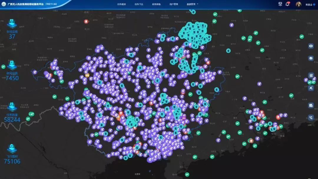
The Guangxi emergency surveying and mapping linkage service platform uses "Heaven Map Guangxi" as the base map, uses Rainbow Four drones as the main equipment, and is connected to multiple brands of drone equipment such as DJI to build a drone emergency surveying and mapping service network. By publishing tasks, receiving orders, recording routes, and transmitting data back on the linkage platform, UAV equipment can be mobilized online in real time to collaboratively perform emergency surveying and mapping tasks.
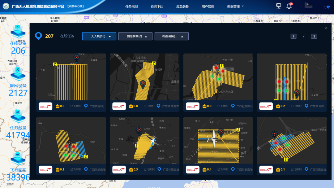
Guangxi is the first country in the country to build a UAV emergency surveying and mapping linkage service platform, which can mobilize drones across the region in real time and efficiently coordinate emergency surveying and mapping tasks. Since the platform was launched, it has been connected to more than 70 units and 168 drones across Guangxi in just 4 months. Through this platform, drones near the mission area can be called online to achieve 2-hour team arrival and 4-hour data return, which greatly improves the rapid response capability of emergency surveying and mapping.
As of the date of publication, the platform has access to 202 user units in the surveying and mapping industry, 509 Rainbow-4 and various industry brand drone equipment, 6,932 terminal equipment, and 9 surveying and mapping equipment.
In addition, the platform is also widely used in daily surveying and mapping. Through this platform, the Guangxi Natural Resources Survey and Monitoring Institute has efficiently obtained key areas for comprehensive monitoring of natural resources pilot areas, areas with difficulty in obtaining satellite remote sensing images, Guangxi highway real estate registration and certification, Guangxi agricultural land survey and other major projects, as well as central environmental protection inspections Involving images of natural resource supervision clue areas, the rapid acquisition of high-resolution image data covering 7,000 square kilometers was completed.
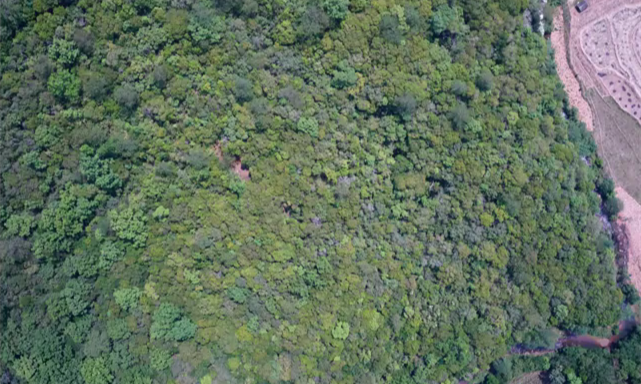
Typical Case Three: Three-dimensional laser series projects
Laser aerial photography projects are the segment with the largest market demand growth in Cheese's business in 2021. Based on the principle of avoiding competing projects with customers, most of the laser projects undertaken by Cheese are challenging projects: on the one hand, it is the difficulty of flying in the survey area itself Higher; on the other hand, the vegetation is dense, but the number of ground points is not low. Taking 5 areas with dense vegetation in the south and 1 operation project in the north as examples, Cheese shared relevant aerial photography parameters for reference by Pegasus customers.
In 2022, Cheese.com will continue to promote the process of industry resource integration, sharing and linkage allocation, and continue to build Cheese.com, an industry resource linkage platform with service capabilities and service quality as its core. At the same time, the vision of Cheese Network - "Visible Remote Sensing Service" is elaborated from multiple dimensions such as service concept, capabilities, scope and guarantee.
