How SLAM100 Solves the Problem of Calculating the Surface Area of Irregular Objects
Plastic rockery has been widely used in garden landscaping art. Its phantom can be seen in theme parks, scenic spots, amusement parks, eco-tourism areas, etc., which shows its status in the current garden landscape. The plastic stone rockery has a peculiar shape and a beautiful shape, but such characteristics make its appearance uneven and extremely irregular, which makes it difficult for engineers and technicians to calculate its surface area. The commonly used formula calculation method, posting calculation method and barbed wire usage calculation method in the industry estimate its surface area. It is conceivable that the accuracy of the calculation results will be greatly reduced.
SLAM100 is a mobile handheld 3D laser scanning device independently developed by us. It is small and portable, and can quickly obtain high-precision 3D laser point cloud data of objects, build a 3D visualization model of complex and irregular scenes, and realize the distance of irregular objects, Geometry information such as surface area and volume can be calculated to meet application requirements such as engineering quantity budget evaluation, landscape planning and construction, and completion acceptance. SLAM100 is used for digital scanning of plastic rockery, which has the following advantages:
(1) 360°×270° full-scene laser field of view, no dead angle in scanning;
(2)3 built-in cameras record the scanning scene, and use point cloud coloring to improve the expressiveness of point cloud;
(3)The industrial-grade SLAM post-processing algorithm guarantees the accuracy of the point cloud (relative accuracy ≤ 2cm), ensuring the accuracy of the surface area results.
Next, let's take the landscape stone of a tourist resort in a coastal city as an example, and follow the SLAM100 to "sweep" it together.
Background and Needs
Landscape stones are widely used in gardens, and can be used for stacking mountains, artificial independent peaks, corner protection, scattered dots, revetments, rock steps, etc. (as shown in the picture below). A tourist resort purchases a batch of landscape stones for park decoration, and needs to measure the surface area of the landscape stones for project accounting and acceptance.
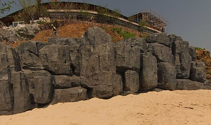
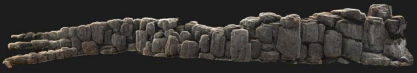
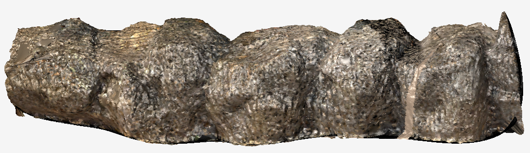
landscape stone front
Field Scanning
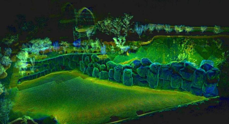
The landscape stones are in a band shape from west to east, about 57m long, and the highest point is about 5.2m from the ground. Due to the occlusion of the viewing angle, the top data cannot be obtained by scanning from the side of the landscape stone. Therefore, it is necessary to scan from the side and top of the landscape stone. The whole point cloud takes about 9 minutes. The key points of field data collection are as follows:
(1)The job site is under construction, and there are many scaffoldings. Before scanning, the path should be planned reasonably, and closed routes and obstructions should be avoided;
(2)The path contains closed loops as much as possible to avoid error accumulation caused by long-term single-path operations;
(3) For places where the scanning is not in place due to the occlusion between the stones, the SLAM100 can be extended into the occlusion to fully obtain the data.
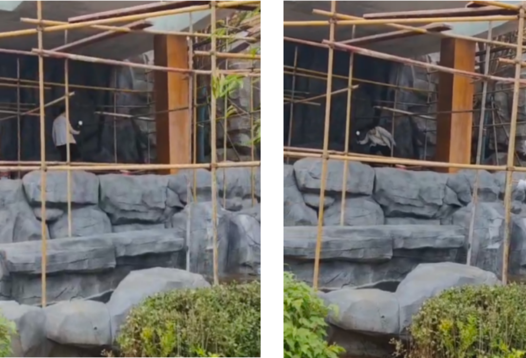
field scanning
SLAM100 scanning trajectory route
Point Cloud Preprocessing
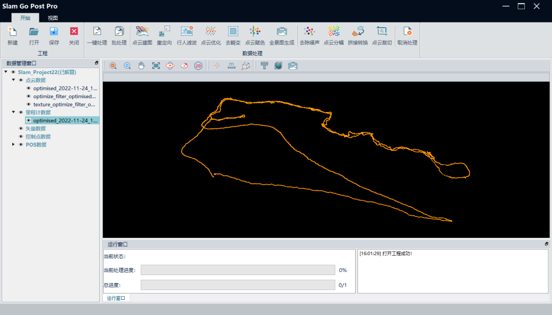
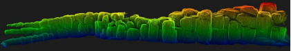
The post-processing software SLAM GO POST Pro was used to output the original point cloud, and the point cloud was optimized to obtain a high-precision point cloud, which took 16 minutes.
High-precision point cloud
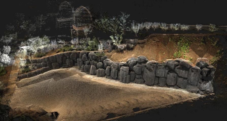
Landscape Stone Point Cloud Clipping
The high-precision point cloud includes construction, preparation, etc., and the landscape stone point cloud is extracted from the original point cloud by manual cutting, which is convenient for later model packaging and repair.
landscape stone point cloud
Model Encapsulation and Surface Area Calculations
Point cloud packaging and model restoration. Its principle is to approximate and restore the solid model with many small spatial triangular patches, so that it will not produce large deformation. The green outline is the boundary of the hole in the initial packaging model. It takes 4 hours to perform surface fitting through the point cloud around the hole, repair the hole, and complete the point cloud packaging. The calculated surface area is 1248.4㎡.
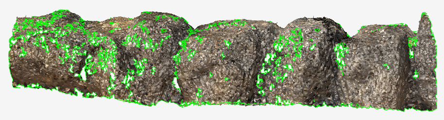
Landscape stone model encapsulation and restoration (partial)
Surface Area Check
It took 2 days for the owner, the supervisor and the construction unit to take over, and the measured area was 1493.7㎡. It took 4.5 hours for us to review and use SLAM100 and supporting software. The measured area was 1248.4㎡, and the reduction was 245.3㎡. 16.4%.
Summary
SLAM100 can quickly and accurately measure the surface area of irregular plastic rockery, and realize digital scanning and visual display of plastic rockery, which is conducive to multiple on-site review by owners and construction units, and provides reliable data support for audit verification.
