Newly Launched-Lidar Module D-LiDAR2110&2210
D-LiDAR2110&2210 is another series of miniature airborne lidar payloads developed by Foxtech Robot based on its own MTC technology. This series of equipment continues the design concept of Foxtech Robot's micro-airborne lidar payload. It uses limited hardware and high-precision algorithms to create a highly reliable and low-cost engineering tool to provide customers with high-precision and high-quality surveying and mapping results.
D-LiDAR2110&2210 is another series of miniature airborne lidar payloads developed by Foxtech Robot based on its own MTC technology. This series of equipment continues the design concept of Foxtech Robot's micro-airborne lidar payload. It uses limited hardware and high-precision algorithms to create a highly reliable and low-cost engineering tool to provide customers with high-precision and high-quality surveying and mapping results.
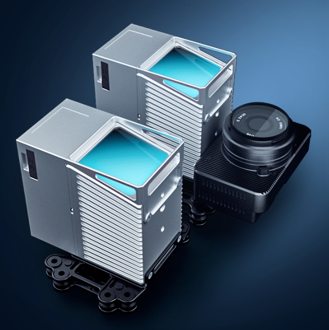
D-LiDAR2210 integrates an APS-C frame camera based on D-LiDAR2110, which can acquire orthophoto and ground texture information while acquiring lidar data.
260m Ranging
Under 80% reflectivity, 260m ranging capability, suitable for low-altitude operations of light and small UAVs.
Highly Automated
Automatic route design, automatic parameter setting, automatic data collection.
70.4°x70.4° Field of View
Larger front and rear field of view, combined with intelligent laser cutting algorithm, makes it easier to protect side data of ground objects.
The payload and flight platform are deeply integrated, and multiple platforms can be switched seamlessly.
High Precision
MTC technology solves the errors caused by the low precision of MEMSIMU of similar lasers and improves the accuracy of results.
Trajectory calculation, data fusion, and accuracy checking are all handled by one-stop software.
Terrain Collection
At 80% reflectivity, the laser still has good vegetation penetration performance with a range of 260m and a typical flight altitude. In the figure below, surface information can still be effectively obtained in the high-density vegetation area in the south in summer.
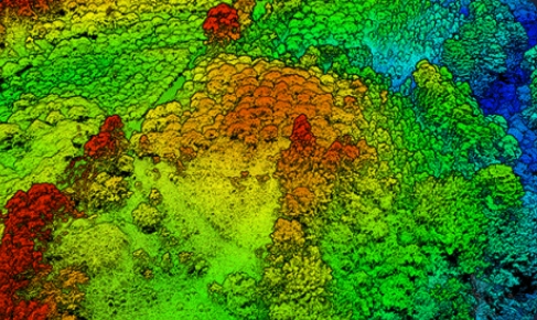
High-density vegetation area renderings
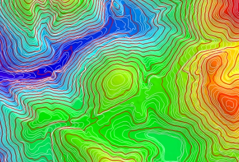
local topographic map
High Precision
Based on MTC technology, the point cloud data between flight zones can be perfectly overlapped, with almost no stratification. Therefore, the thickness and detail performance of surface data will be better, and the accuracy of the results can be more easily guaranteed. The following data are obtained at an altitude of 100m.
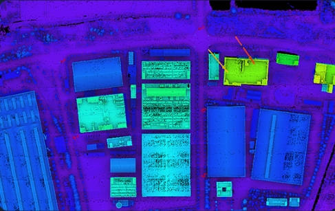
Overall bird's eye view of the factory
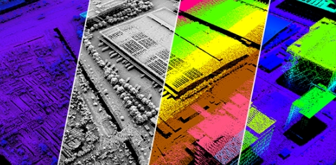
Surface data renderings
